Log in
All resources
Create a design
265 Free Artworks of Mississippi River
carte du mexique et de la floride by guillaume delisle (1703)
university of washington
frank leslie
das illustrirte mississippithal, henry lewis, 1857
henry lewis
maps by john cary
john cary
philippe buache
backs of postcards in curt teich postcard archives
american civil war in 1862
backs of postcards in curt teich postcard archives
curt teich postcard archives, curt teich & company
postcards of memphis, tennessee
maps by peter lesley
maps by james hall
curt teich postcard archives
postcards of missouri
mississippi river at new orleans
1841 in new orleans
1803 maps of the caribbean
maps by john cary
backs of postcards in curt teich postcard archives
drawings by alfred waud
1871 drawings
naval ships of the confederate states of america
samuel sartain
frank leslie's illustrated newspaper, 1860
1860 in new orleans
maps in the library of congress
1744 maps of north america
postcards of new orleans published by detroit publishing co.
curt teich postcard archives, detroit publishing company
1870s maps of kentucky
maps of the ohio river
harper's weekly, 1862
alexander simplot
das illustrirte mississippithal, henry lewis, 1857
illustrations of native americans
carte du mexique et de la floride by guillaume delisle (1703)
maps in the library of congress
frank leslie's illustrated newspaper, 1863
henri lovie
collections of the missouri history museum
daniel boone
picturesque america; or, the land we live in (1872)
orientalism
mississippi river at new orleans
1852 in new orleans
carte du mexique et de la floride by guillaume delisle (1703)
bibliothèque nationale de france
1740s maps of the caribbean
daniel de la feuille
das illustrirte mississippithal, henry lewis, 1857
st louis fire (1849)
portrait of george washington by giuseppe perovani
giuseppe perovani
1790s maps of central america
1790s maps of cuba
physical geography (1899) by davis
old maps of the mississippi river
physical geography (1899) by davis
old maps of the mississippi river
physical geography (1899) by davis
maps of the mississippi river
1690s maps of the caribbean
1690s maps of the americas
postcards of st. louis, missouri
curt teich postcard archives
lawrence h. slaughter collection of english maps, charts, globes, books and atlases
nypl lionel pincus and princess firyal map division
carte du mexique et de la floride by guillaume delisle (1703)
bibliothèque nationale de france
1805 maps of the united states
maps by john cary
backs of postcards in curt teich postcard archives
poplar street bridge
camp-fire and cotton-field- southern adventure in time of war. life with the union armies, and residence on a louisiana plantation (1865)
1865 books
lawrence h. slaughter collection of english maps, charts, globes, books and atlases
1700s maps of north america
the frieze of american history
hernando de soto
hand-colored photographs of the united states
jefferson davis in art
das illustrirte mississippithal, henry lewis, 1857
saint paul, minnesota in the 1850s
das illustrirte mississippithal, henry lewis, 1857
native americans in 19th-century art
das illustrirte mississippithal, henry lewis, 1857
steamboats on the mississippi river
media contributed by university of illinois urbana-champaign university library
carte du mexique et de la floride by guillaume delisle (1703)
lawrence h. slaughter collection of english maps, charts, globes, books and atlases
covens en mortier
frank leslie's scenes and portraits of the civil war (1894)
henri lovie
19th-century watercolor paintings in the united states
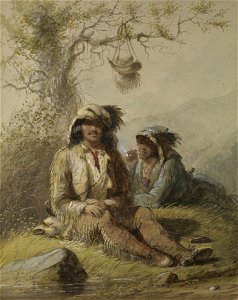
alfred jacob miller: an artist on the oregon trail
thomas easterly daguerreotype collection
st. louis levee
1800s maps of the americas
maps by john cary
travels in the interior of north america, during the years 1832–1834
works by maximilian zu wied-neuwied
maps by john cary
1799 maps
lithographs
realism
1740s maps of the americas
1747 maps of north america
carte du mexique et de la floride by guillaume delisle (1703)
bibliothèque nationale de france
maps by louis brion de la tour
1786 maps of north america
french-language maps of north america
1809 maps of north america
carte de barbarie, nigritie, guinée par guillaume delisle (1707)
university of washington
drawings by alfred waud
harper's weekly, 1867
carte des côtes de malabar et de coromandel (1723)
philippe buache
carte de l'afrique françoise par guillaume delisle (1726)
philippe buache
1779 maps of the united states
1770s maps of the caribbean
cartouches by guillaume delisle
philippe buache
1696 maps of the caribbean
1690s maps of mexico
carte de l'isle de ceylan by guillaume delisle (1722)
philippe buache
frank leslie's illustrated newspaper, 1881
henry frank (ship, 1878)
carte de moscovie by guillaume de l'isle (1706)
university of washington
united states house of representatives
john plumbe
201 - 265 of 265
/ 3